

 Spots of the FishingTheSpot
 Catch of members
 My fishing logbook
A map mode and a list mode
Fishing spots in map mode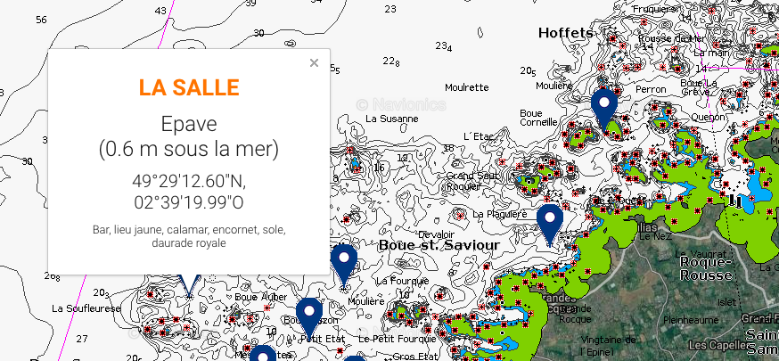 Fishing spots in list mode : expert spots
 Fishing spots in list mode : Catch of members
How to display the spots
The spots are reserved for Premium members of our Club.
You can test your Club for free for 10 days.
The spot map FishingTheSpot
With ComptoirDesPêcheurs, you can :
Access to the types of funds and bathymetric curves
Show on the map our 45 000 fishing spots referenced by our experts.
View thousands of Collaborative spots from Club members.
Access to the types of funds and bathymetric curves (sea fishing)
By clicking on "Show Seabed" at the top left of the map, you will see an ideal Navionics basemap to locate suitable areas for sea fishing. Bathymetric Curves, Bottom Type (Sand / Rock / Vessel) or depths are all data available for free directly on the map. To learn how to read a nautical chart, you can click here
Show on the map our 45 000 fishing spots referenced by our experts
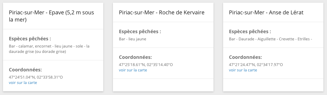
Experts spots at sea
You will find for each spot of fishing at sea :
the name of the spot,
the type of spot (wreck, buoy, rocky plateau, cove, jetty ...),
the species fished on the spot,
GPS coordinates.
The expert spots in freshwater
You will find for each fishing spot in freshwater :
stream category,
the name of the federation and AAPPMA in charge of the spot,
the fishing map needed,
the name of the spot,
the type of spot (pond, river, river, lake ...),
the GPS coordinates of the spot,
the species fished on the spot.
View thousands of Collaborative spots from Club members.
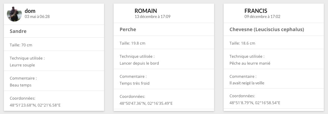
Shared catches
You will also find on the map all the catches shared by our thousands of anglers members of the Club. For each catch, find
the name of the fisherman,
the fished species,
the picture of the catch,
the GPS coordinates of the spot (if the fisherman has shared them),
the fisherman's comment on the technique and equipment used.